How do farms affect fish?
PROJECT
How do farms affect fish?
Mariculture Research and Restoration Consortium: Mariculture with Biological Communities, Pelagic Fish
Background
The mariculture industry has potential to provide ecological benefits and economic diversity to Prince William Sound. Both seaweed and oyster farming can benefit young fish by providing a refuge from predators and conditioning of marine habitat. Commercial fishermen stand to benefit from the mariculture industry as they already own much of the necessary equipment and farming is flexible and can be a source of income in the off-season for fishing. Many fishermen and commercial fishing stakeholders are interested in how mariculture may affect fish populations. Researchers at the PWS Science Center are working to address this question through two methods: 1) by estimating fish density and distribution in bays relative to developed mariculture farms, and 2) by evaluating if and how fish use farm infrastructure.
Methods
1. Estimate how fish biomass changes along transects near farms in PWS bays where mariculture is already under development.
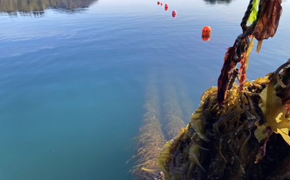
We will use well-established hydroacoustic survey methods to estimate fish biomass within bays with varying levels of mariculture development. Fixed, zigzag transects (inclusive of nearshore/offshore, inner/outer bay, and distance to farm gradients) will be completed in Simpson (existing farms), Sheep (issued farm leases), and St. Matthews bays (no leases) four times a year (winter, spring, summer, fall). To estimate fish biomass along transects we will use an echosounder with a 120 kHz split beam transducer mounted downward on the hull of the survey vessel. The echosounder will transmit pings with the transducer positioned 1-2 m below the surface. The survey vessel will move at a rate of 5 knots during the transect and position will be recorded using a GPS unit. Data generated from hydroacoustic surveys will be used to estimate fish biomass as a function of distance from existing and developing farms and control sites. From this data we can generate maps that show fish density along the path of our vessel and determine whether fish are more concentrated near farms.
2. Evaluate whether and how fish utilize farming infrastructure over the course of the farming season.
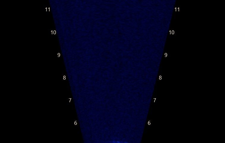
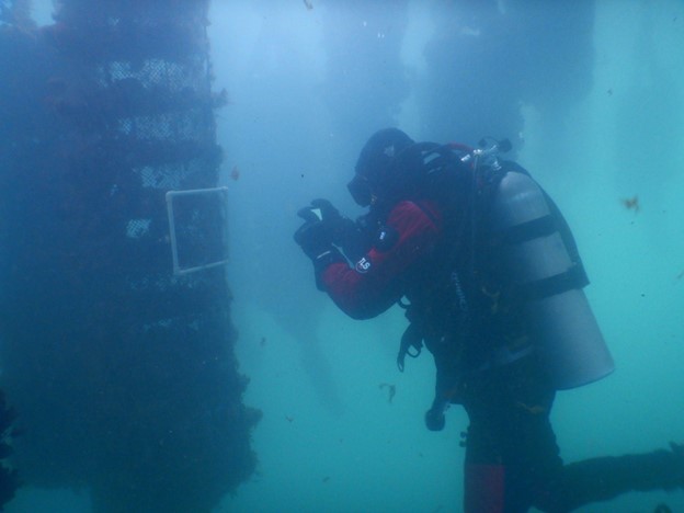
We will use dual frequency, multibeam imaging sonars to calculate the abundance and behavior of fish near farms at three time points throughout the farming season (fall, summer, spring). This technology, in combination with cameras, provides a means to see fish interacting with farms when they are empty, recently out-planted, and close to harvest. Fish counts and identification will tell us what species are using farming infrastructure. We can also evaluate their behavior and determine whether they are hiding within farming infrastructure or utilizing the farms to capture prey.
What We Are learning
This project will enable us to evaluate if and how mariculture farms impact fish distribution and behavior. To date, we have surveyed farms in Windy Bay and Sheep Bay and have captured images of large fish and schools of smaller fish interacting with farms (see video below).
PRINCIPAL INVESTIGATORs
Dr. Alysha Cypher
Prince William Sound Science Center
acypher@pwssc.org
Collaborators
Mariculture Research and Restoration Consortium
RESEARCH PERIOD
2022-2031
FUNDING
Exxon Valdez Oil Spill Trustee Council
-

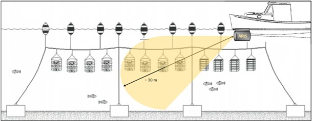
- This map shows the fixed, zigzag transects that are surveyed in Simpson, Sheep, and St. Matthews bays, Prince William Sound. Transects are also surveyed in Kachemak Bay and Kodiak, Alaska. Click image to enlarge.
-
- Dual frequency, multibeam imaging sonars will be used to calculate the abundance and behavior of fish near farms. Click image to enlarge.
-
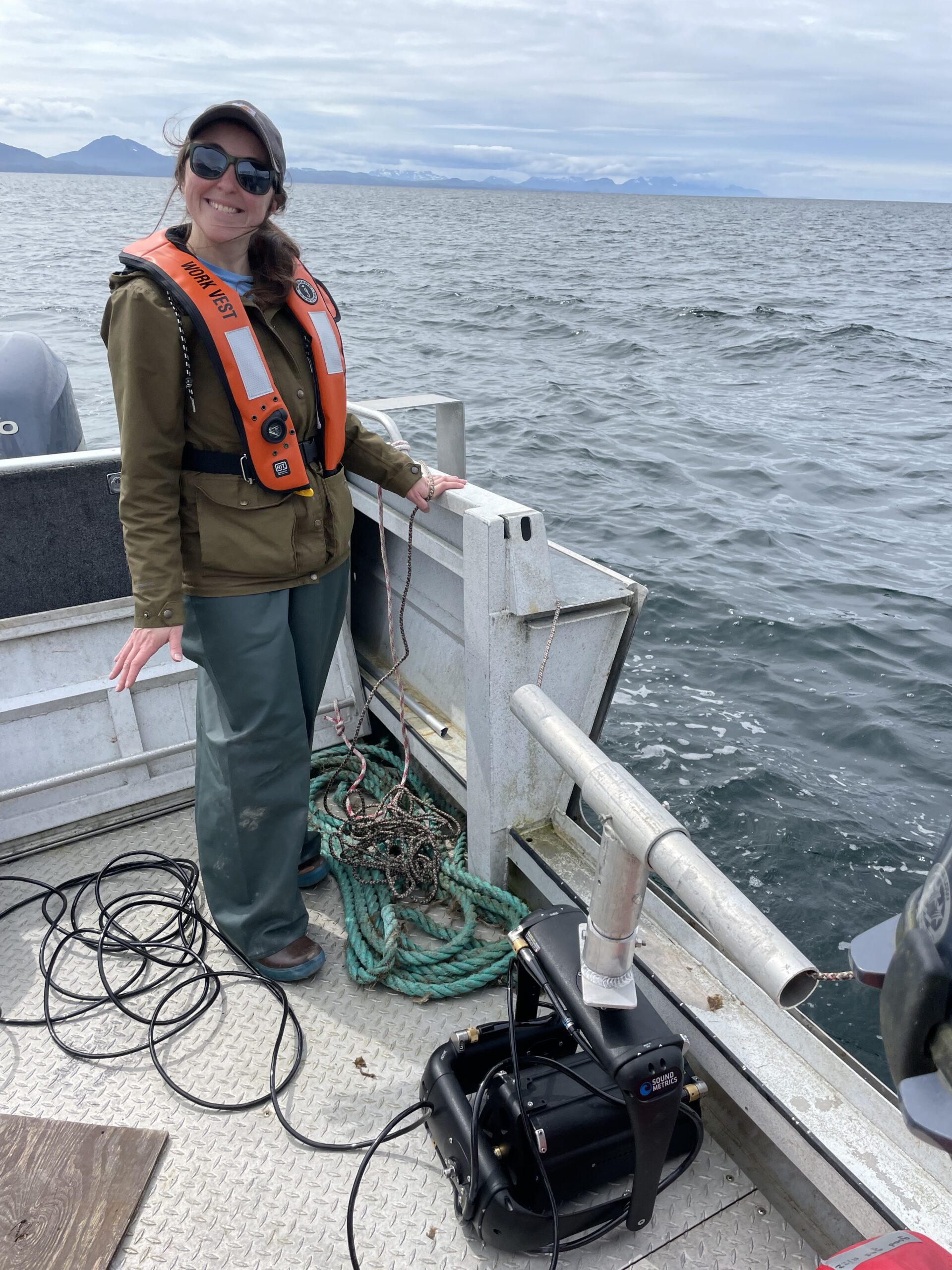
- Alysha Cypher, a biologist at PWSSC, preparing to deploy the imaging sonar in the Native Village of Eyak farm in Sheep Bay.